




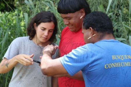
Researcher Isabella Coelho de Oliveira teaching members of the guardian group how to use the app to collect spatial data (photo: Matheus S. Barros Mawanaya Waurá)
A study combining remote sensing, geographic data science, and field research shows that the Xavante territory has preserved its environmental configuration, while neighboring areas have been converted to large-scale soybean farming and livestock ranching.
A study combining remote sensing, geographic data science, and field research shows that the Xavante territory has preserved its environmental configuration, while neighboring areas have been converted to large-scale soybean farming and livestock ranching.
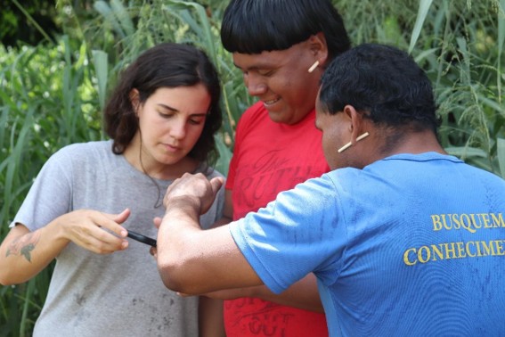
Researcher Isabella Coelho de Oliveira teaching members of the guardian group how to use the app to collect spatial data (photo: Matheus S. Barros Mawanaya Waurá)
By José Tadeu Arantes | Agência FAPESP – “An island of biodiversity in a sea of monoculture”: this is how a recent stud characterized the Pimentel Barbosa Indigenous Territory (TIPB), located in the northeast of the state of Mato Grosso in Brazil’s Central-West region. The study showed that the area’s human occupation patterns and vegetation cover have remained largely unchanged for four decades. Meanwhile, the surrounding area has been altered by the expansion of livestock ranching, soybean farming, and the construction of major highways (BR-158 and BR-163), which are part of Brazil’s efforts to extend its agricultural frontier. The TIPB covers 329,000 hectares and was home to 2,369 people in 2022, according to a census by the Brazilian Institute of Geography and Statistics (IBGE).
The people of the A’uwẽ Xavante ethnic group obtained official recognition of their land through Decree 93,147 of 1986. “Since then, over the course of these 40 years, the landscape of the TIPB has remained virtually unchanged, dominated by the natural vegetation characteristic of the Cerrado, with savanna formations, forest fragments, and wetlands. Meanwhile, in the surrounding areas, a continuous and targeted transformation has taken place. The natural formations have almost disappeared, giving way to pastures and agricultural crops, primarily soybeans,” says Isabella Coelho de Oliveira, the lead author of the study.
In 2024, the research received the Scientific Merit Award at the 32nd Congress on Scientific Initiation at the State University of Campinas (UNICAMP) and was published in May in the journal Geocarto International.
The study analyzed changes in land use between 1985 and 2024 within the TIPB and within a 50-kilometer radius of the territory. Using annual data from Collection 10 of the MapBiomas Project – a collaborative network of non-governmental organizations, universities, and technology startups that maps land cover and land use in Brazil – and multivariate statistical techniques, the study identified temporal patterns of landscape transformation. This large-scale survey was supplemented by an ongoing dialogue with the Xavante community and field research, which included four research stays on the indigenous land. This research involved cartographic work, participation in the Warã (daily assemblies), and living alongside the local population.
“When Isabella told me about ‘territorial isolation,’ I said to her, ‘That term doesn’t exist in the literature. You have a major study on your hands.’ I was excited to participate,” says Anderson Targino Ferreira, a researcher at the Center for Lasers and Applications (CELAP) of the Institute of Energy and Nuclear Research (IPEN) and the Institute of Geosciences (IG) at UNICAMP. He worked on the geotechnologies and statistical analysis aspects of the project. According to Ferreira, the MapBiomas data made it possible to track nearly four decades of landscape transformation. “Initially, there was ecological continuity between the interior and exterior of the indigenous land, but over time, the surrounding area became fragmented by agricultural expansion, while the interior remained relatively preserved.”
The researchers identified three phases of this process. The first, the “basal phase,” occurred between 1985 and 1995 and was still dominated by native vegetation. The second, the “transitional phase,” occurred from 1996 to 2012 and was marked by deforestation and the expansion of pastures. The third, the “consolidation phase,” occurred between 2013 and 2024 and was characterized by the dominance of agroindustrial land uses, primarily soybean cultivation and large-scale livestock farming. “It was an intense process of eliminating local biodiversity, leaving behind precisely the territory defined by the TIPB,” Ferreira summarizes.
“That contrast supports the concept of ‘territorial islanding,’ used in the study to describe relatively preserved socio-ecological territories that persist as ‘islands’ amid landscapes profoundly transformed by economic development,” comments Vicente Eudes Lemos Alves, a professor at IG-UNICAMP who supervised Oliveira’s research.
“You only need to travel from south to north along BR-158 to notice that contrast. On one side lies the preserved indigenous land, with the forest still standing; on the other, areas completely deforested for soybeans and cattle,” says the researcher. According to her, the fieldwork was crucial for understanding the territorial situation: “During my four visits – one of which was supported by my advisor and course mates in the TIPB – the community leaders informed me about which surrounding activities were putting pressure on the indigenous land and how they were expanding through deforestation. They asked me to guide the youth group in creating their own maps to produce cartographic materials to be used as a means of defending and monitoring the territory.”
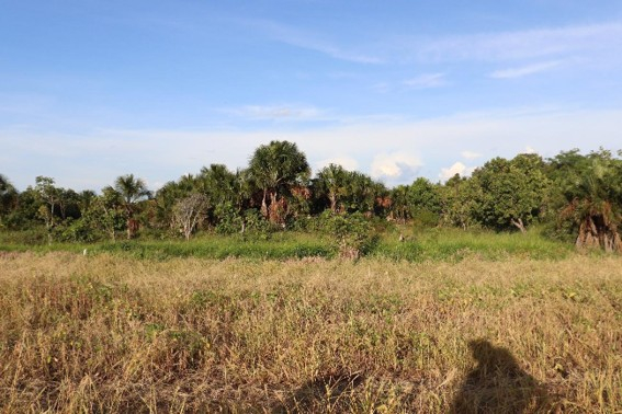
In the foreground, land cleared for agriculture and livestock. In the background, the preserved biodiversity of the Pimentel Barbosa Indigenous Territory (photo: Isabella Coelho de Oliveira)
Exchange of knowledge
In partnership with the Xavante Association of Pimentel Barbosa, Oliveira organized workshops to identify which areas needed to be mapped and to teach the local population how to use a GPS-based app designed for data collection. “People learned how to use the app and export the waypoints – the first step in creating the map. Although subsequent technical steps are involved, such as working with geoprocessing software, they achieved their goal of marking the beginning of their autonomy to produce their own maps. It was a very enriching exchange of knowledge. I learned from them how to understand the space and territory, or Ró, from the Xavante Indigenous perspective, and they learned from me how to use scientific knowledge available at the university and contemporary technological resources to defend their land and preserve the environment,” she reports.
Maria Carolina Ribeiro, a researcher from the São Paulo Center for Energy Transition Studies (CPTEn) who also participated in the study, points out that the work directly addresses several of the United Nations’ Sustainable Development Goals (SDGs). “The study specifically addresses SDG 10 (Reduced Inequalities), SDG 13 (Climate Action), SDG 15 (Life on Land), and SDG 16 (Peace, Justice, and Strong Institutions). And we also believe that this research can contribute to the recognition of SDG 18, focused on ethnic and racial equality – a proposal championed by the current Brazilian government in international forums,” she states.
Bastions of socio-environmental preservation
The study contextualizes the observed transformations within broader historical processes of land concentration and land use conversion in Brazil. The authors argue that state policies implemented throughout the 20th century, including incentives for settlement in the Central-West and logistical integration and infrastructure expansion, contributed to the accelerated incorporation of the Cerrado into global agricultural commodity chains. Consequently, the Cerrado, which is crucial for biodiversity and preserving continental water resources, has become one of Brazil’s most endangered biomes (read more at agencia.fapesp.br/52330).
The study also highlights the hydrological and climatic impacts associated with the conversion of native vegetation. Replacing the Cerrado with mechanized monocultures and extensive pastures reduces water infiltration into the soil, compromises aquifer recharge, and alters atmospheric moisture flows. The authors state that these processes affect the so-called ”flying rivers” – atmospheric systems that transport water vapor from the Amazon and the Cerrado to other regions of South America. The reduction in evapotranspiration caused by deforestation decreases the availability of moisture for rainfall formation, making regions more vulnerable to droughts and extreme weather events.
“In this context, indigenous lands have become bastions of socio-environmental preservation. The study shows that the stability observed in the TIPB stems not only from formal demarcation, but also from the continuity of indigenous territorial governance systems. Today, virtually all the original vegetation has disappeared from the surrounding area. What has remained is precisely what the indigenous lands have protected,” Alves emphasizes.
The authors emphasize that for the A’uwe Xavante people, the Cerrado, or Ró, is more than just a material basis for subsistence; it is also a central element of their cultural identity. This is evident in their practices of hunting, fishing, gathering, traditional agriculture, rituals, and social organization. “For the A’uwe Xavante, the territory isn’t limited to the officially demarcated area. It also encompasses the Cerrado, the forest, the rivers, the flora, the fauna, the spirits, and an entire cosmological conception of the world,” notes Oliveira.
Oliveira conducted her research with scholarships for Scientific Initiation and for a Research Internship Abroad funded by FAPESP.
The article “Revealing indigenous territorial islanding in an agricultural frontier through land-use trajectories and multivariate analysis” can be read at www.tandfonline.com/doi/full/10.1080/10106049.2026.2670932.
The Agency FAPESP licenses news via Creative Commons (CC-BY-NC-ND) so that they can be republished free of charge and in a simple way by other digital or printed vehicles. Agência FAPESP must be credited as the source of the content being republished and the name of the reporter (if any) must be attributed. Using the HMTL button below allows compliance with these rules, detailed in Digital Republishing Policy FAPESP.
