


With the aim of enhancing the quality of Brazilian space research output, scientists investigated the accuracy of different satellite data collections (photo: Wikimedia Commons)
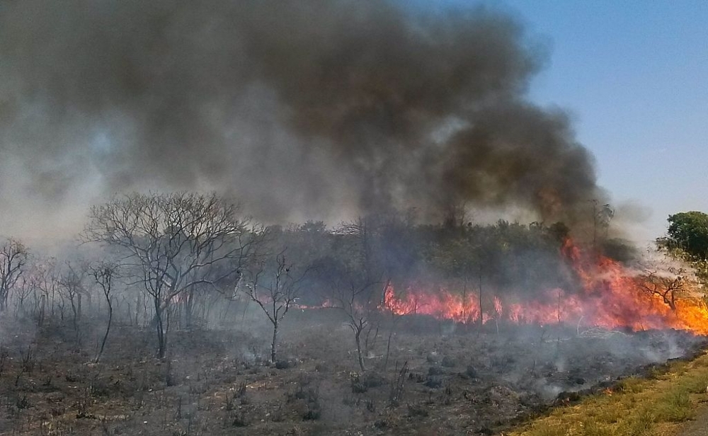
With the aim of enhancing the quality of Brazilian space research output, scientists investigated the accuracy of different satellite data collections.
With the aim of enhancing the quality of Brazilian space research output, scientists investigated the accuracy of different satellite data collections.
With the aim of enhancing the quality of Brazilian space research output, scientists investigated the accuracy of different satellite data collections (photo: Wikimedia Commons)
By José Tadeu Arantes | Agência FAPESP – A study conducted by scientists from Brazil, the United States and Portugal investigated the accuracy and consistency of different satellite data collections with regard to the location and size of burned areas in the Cerrado biome, the Brazilian savanna.
The results, published in the International Journal of Applied Earth Observation and Geoinformation will help improve the output produced by Programa Queimadas, a program run by Brazil’s National Space Research Institute (INPE) to monitor wildfires and burns by satellite and to calculate and forecast forest fire risk.
The study was linked to the Brazilian Fire-Land-Atmosphere System (BrFLAS), a project supported by FAPESP. Its principal investigator was Renata Libonati, a professor at the Federal University of Rio de Janeiro (UFRJ) in Brazil, in collaboration with researchers at the University of Maryland (USA) and the University of Lisbon (Portugal). The study was also one of several projects conducted as follow ups to the master’s research of the first author Júlia Abrantes Rodrigues.
Several previous studies showed that fire – which can be used intelligently as part of a properly considered strategy with total area zoning and a rotating fire schedule – is indispensable to renewal the Cerrado (read more at agencia.fapesp.br/26064).
The indiscriminate, often criminal, use of fire to eliminate native plants and prepare land for crops and extensive cattle raising is a different story. “In this case, areas are burned repeatedly at very short intervals, almost always in the dry season, and no vegetation can survive. Natural adaptation is impossible,” environmental engineer Alberto Setzer told Agência FAPESP. Setzer is a researcher at INPE and a coauthor of the article.
The image below, produced by the scientists involved in the project, shows fire scars throughout the Cerrado on the basis of 2017 data. The image at the end of this article, produced by the same team, shows the annual change in burned areas in the 2003-17 period, highlighting the major wildfires of 2007 and 2010.

“A most important aspect to consider is the atmospheric emissions from burning. Depending on the year, they can account for between 28% and 75% of Brazil’s total carbon emissions, contributing substantially to global estimates, as Brazil ranks seventh among the world’s countries that are the largest sources of carbon emissions. Even 28% is very significant, while 75% is extremely serious,” Setzer said.
“The Amazon was the main concern in the past as far as fire was concerned, but the burning in the Cerrado has become very alarming. This biome, particularly the part known as MaToPiBa [an acronym that designates the area at the intersection between the states of Maranhão, Tocantins, Piauí and Bahia], has become a magnet for large-scale agricultural projects. For example, western Bahia has undergone brutal devastation, and almost all the natural vegetation has been removed.”
Setzer noted that this change has been very drastic and swift and that the scientific community is practically unaware of it. Hence, the timeliness of this new study, which set out to answer the following question: “How much of the Cerrado is being burned?”
Data from satellites operated by reliable organizations such as NASA and the European Space Agency (ESA) are global in scale and relatively imprecise for the study of regional phenomena, according to Setzer.
“It was in this specific respect that we set out to enhance the quality of INPE’s output for use in measuring burned areas,” Setzer said. “The study shows the limitations and errors of both global-scale estimates and those produced by INPE. The aim was to refine our data to arrive at more precise information on burned areas, including what, when and where data, as well as the resulting emissions.”
The Programa Queimadas portal offers current data on the subject. At a resolution of 1 km, it is possible to obtain data on the total burned area and burned areas by biome, year by year and month by month, as well as each biome’s percentage of total burned area. The maps also show each biome’s fire scars. The portal offers LANDSAT quadrant images, maps, and other detailed information for the Cerrado at a resolution of 30 m.
“In our study, we calculated the errors and uncertainties of the data provided by the satellite images. It’s the first study of the kind for the Cerrado. We also found that the data are more reliable for the northern than for the southern Cerrado. This is because properties in the southern part of the biome are far smaller, so the use of fire occurs in relatively small areas rather than over very large swathes of land. In the northern portion, in areas such as Bananal Island, we measured almost continuous fires in areas as large as 10,000 km2 in some years. That never happens in parts of northern São Paulo or southern Minas Gerais [Southeast Brazil], where the land-use pattern is quite different. It’s an important finding because it shows you can’t have a single algorithm for the entire biome,” Setzer explained.
At present, the impact on the Cerrado is greatest in areas of arable land. “The Cerrado is being practically destroyed, and the land is being converted to crops or pasture. In most cases, this is being done in breach of the environmental legislation. In the Amazon, the law requires that 80% of any property must be left untouched. In the Cerrado, this requirement applies to only 30%, but even that small proportion isn’t enforced,” he said.
The article “How well do global burned area products represent fire patterns in the Brazilian Savannas biome? An accuracy assessment of the MCD64 collections” by Julia A. Rodrigues, Renata Libonati, Allan A. Pereira, Joana M. P. Nogueira, Filippe L. M. Santos, Leonardo F. Peres, Ananda Santa Rosa, Wilfrid Schroeder, José M. C. Pereira, Louis Giglio, Isabel F. Trigo and Alberto W. Setzer can be retrieved from: www.sciencedirect.com/science/article/pii/S0303243419300248.

The Agency FAPESP licenses news via Creative Commons (CC-BY-NC-ND) so that they can be republished free of charge and in a simple way by other digital or printed vehicles. Agência FAPESP must be credited as the source of the content being republished and the name of the reporter (if any) must be attributed. Using the HMTL button below allows compliance with these rules, detailed in Digital Republishing Policy FAPESP.
