




The system resolves discrepancies in data released by different satellites, which vary in resolution, frequency, and technology (photo: Léo Ramos Chaves/Pesquisa FAPESP)
Digital Amazon, an initiative of the RCGI, a FAPESP Applied Research Center, consolidates data from satellites, towers, and sensors, enabling in-depth analyses of CO₂ emissions and absorption.
Digital Amazon, an initiative of the RCGI, a FAPESP Applied Research Center, consolidates data from satellites, towers, and sensors, enabling in-depth analyses of CO₂ emissions and absorption.
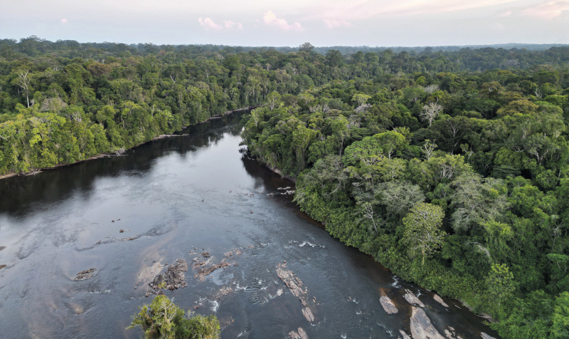
The system resolves discrepancies in data released by different satellites, which vary in resolution, frequency, and technology (photo: Léo Ramos Chaves/Pesquisa FAPESP)
Agência FAPESP* – The Digital Amazon platform, which integrates data on greenhouse gas (GHG) emissions and removals from the Amazon rainforest, is now available to the public. Developed as part of the “Greenhouse Gas Emissions in the Amazon: Data Analysis System and Service” project by the Research Center for Greenhouse Gas Innovation (RCGI), the tool gathers information from the nine Amazonian countries and allows for an integrated analysis of regional GHG dynamics.
The RCGI is an Applied Research Center (ARC) established with support from FAPESP and Shell, as well as other companies. It is headquartered at the Engineering School of the University of São Paulo (POLI-USP) in Brazil.
“This is the first platform to bring together, in an integrated manner, data from satellites, measurement towers, and other sensors on the carbon cycle in the Amazon rainforest. This represents a fundamental advance for science and for formulating effective public policies in the face of climate change,” says Paulo Artaxo, a professor at the USP Physics Institute and project coordinator.
Digital Amazon consolidates previously scattered information into a unified database, organizing data essential for understanding the Amazon’s role in the global dynamics of GHGs – particularly carbon dioxide (CO₂) and methane (CH₄). This centralization enables tasks that once required days of preparation and organization to be completed in a matter of minutes, greatly enhancing researchers’ productivity.
The system also resolves discrepancies in data released by different satellites that vary in resolution, frequency, and technology. Analyses possible with Digital Amazon include the impact of forest degradation on emissions, the effects of El Niño and La Niña on atmospheric GHG concentrations, calculating methane emissions in wetlands, and the effects of agricultural expansion and changes in rainfall patterns on forest photosynthetic processes.
Initially, the data covers the period between 2003 and 2017 and brings together information obtained from satellites, towers (such as the Amazon Tall Tower Observatory), surface sensors, and meteorological and environmental databases. The next step is to update the dataset through 2024, expanding the temporal scope of analyses and strengthening continuous monitoring of the region.
Environmental big data
Digital Amazon is a data space, that is, a digital framework designed for the integration and smart processing of large amounts of complex data. Specifically, it organizes and integrates environmental data from various sources and formats, such as satellites, ground-based sensors, and measurement towers, into a unified environment that ensures curation, traceability, and interoperability.
“All of this infrastructure is hosted on the Amazon Web Services cloud, ensuring remote access, scalability, and security. This enables robust analysis and paves the way for the use of artificial intelligence in searches, inferences, and decision-making. It’s a concrete application of big data principles focused on the complexity of the Amazon rainforest,” says José Reinaldo Silva, a professor at POLI-USP and deputy project coordinator.
One of the next planned advancements is the development of an intuitive visualizer designed for non-expert users. To complement fixed towers and satellites, prototypes of drones capable of collecting atmospheric data in remote areas of the forest have been developed. The plan is to operate the drones from barges in the Amazon basin to expand access to regions difficult to reach by land.
The system is set up to synchronize with other databases and may be integrated with international platforms, such as Global Forest Watch, in the future. Periodic reports with interpretive analyses are also planned to inform evidence-based public policy formulation.
“Our goal is to provide a robust infrastructure so that researchers, public officials, and members of civil society can closely monitor the role of the Amazon rainforest in the global carbon balance,” says Silva. “Now that we have a solid technological foundation, we’re seeking support to ensure the project’s continuity and expansion.”
Digital Amazon can be accessed via the RCGI website, with different access levels granted based on the user’s profile.
* With information from the RCGI
The Agency FAPESP licenses news via Creative Commons (CC-BY-NC-ND) so that they can be republished free of charge and in a simple way by other digital or printed vehicles. Agência FAPESP must be credited as the source of the content being republished and the name of the reporter (if any) must be attributed. Using the HMTL button below allows compliance with these rules, detailed in Digital Republishing Policy FAPESP.
