Plans that never left the drawing board
Study analyzes the plans for building Brazil’s roadway network, drafted between 1869 and 1889, the modernizing forces that inspired them and the conservative resistance that caused them to fail.
Plans that never left the drawing board
Study analyzes the plans for building Brazil’s roadway network, drafted between 1869 and 1889, the modernizing forces that inspired them and the conservative resistance that caused them to fail.

Study analyzes the plans for building Brazil’s roadway network, drafted between 1869 and 1889, the modernizing forces that inspired them and the conservative resistance that caused them to fail
By José Tadeu Arantes
Agência FAPESP – Keeping a nation of continental dimensions intact and expanding its borders even farther were goals that went hand in hand among the Brazilian political and economic elite during the Empire of Brazil Period.
Plans laid for transportation systems during the Second Reign show us a great deal about the ambiguities of this elite class. These plans sought to connect the most remote points of the gigantic national territory, to make the Brazilian economy part of the world market and to consolidate a centralized national State, but they never left the drawing board.
Conceived by “modernizing” engineers fascinated with the capitalism-driven transformations under way in Europe and the United States, these plans were abandoned largely because of resistance from the agrarian elite, who wanted the comfort of the telegraph but did not want to lose slave labor. The consequences of the abandonment of the plans are still felt today.
The particularity of the topic—historical but at the same time highly relevant to the current situation —is one of the factors that justify its treatment from the conceptual perspective of a geographer.
This is exactly what Professor Manoel Fernandes de Sousa Neto of the Geography Department in the School of Philosophy, Literature and Humanities at the Universidade de São Paulo (USP) did in his doctoral thesis, which he defended at USP in 2004 and which has recently been published as a book with the aid of
FAPESP funding.
In Planos para o Império: Os planos de viação do Segundo Reinado (1869-1889) [Plans for the Empire: The Second Reign’s plans for roadways (1869-1889)], Sousa Neto considers the influence of the colonial past in the structuring of the Brazilian territory and highlights the fragility of the centralized State during the Empire of Brazil, which was evident from the Paraguayan War. The book also looks closely at five transportation system plans developed during the two decades between 1869 and 1889, the impetuses for modernization that inspired them and the conservative resistance that led to their demise.
Aside from resistance from the oligarchy, why did these plans fail? “First of all, because the project wasn’t really intended to modernize the country and incorporate the entire territory into the capitalist system where capital, merchandise and people circulated freely. Rather, it was intended to maintain a vast territorial fund for future incorporation under the aegis of the branches of the agrarian bourgeoisie,” answers Sousa Neto.
“Later, there was the problem of the physical dimensions of the territory and difficulties with natural features, such as steep topography in some regions and broad flood plains and thick forests in others, requiring large investments and infeasible technical solutions in engineering,” the geographer continued.
“Finally, we have to remember that the territory was not empty. It was inhabited by many indigenous peoples who had resisted many modernizing projects that had been proposed by capitalism both before and after that time in history,” he said.
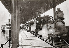
Because these plans, in addition to waterway navigation, mostly proposed the construction of railways (the technological option during that age), it is interesting to compare here—even though this was not one of the book’s objectives—the extension of railways in both Brazil and India. Both countries are classified as underdeveloped and today are found on the list of the so-called emerging economies.
With a land area of 2,973,193 square kilometers, India had 63,974 kilometers of railway in 2009, most of which was installed during the period of British control. In 2008, Brazil, which has 8,459,417 square kilometers of territory (nearly triple India’s size), had 28,538 kilometers of railways (CIA World Factbook, 10/10/2012).
There has been a modest expansion of the Brazilian railway system since that time, and in 2012 it reached 28,692 kilometers (National Land Transportation Agency, August 2012).
What were the main consequences of this failure to fulfill the plans for Brazil’s transportation systems? “There were many,” affirmed Sousa Neto. “Sectors related to mining and hydro-agribusiness, for example, want complex transportation systems in the western regions of the country to transport products at the price of environmental destruction and to export products at competitive prices. Transportation costs directly affect profit margins.”
“The book looks at the plans elaborated during the Empire of Brazil not only as transportation plans but also as projects for the country. The book seeks to understand which projects were in play and how they underwent changes or continue to need solutions today today,” he added.


