


Database contains information such as the length of the bus corridor in kilometers, the company responsible for its operation, identifies the name of the corridors and the year in which the corridor (or part of it) came into operation, and the municipality in which the corridor is located (photo: Wilfredor/Wikipedia)
Center for Metropolitan Studies research covers nearly 200 kilometers of roads in the Metropolitan Region.
Center for Metropolitan Studies research covers nearly 200 kilometers of roads in the Metropolitan Region.
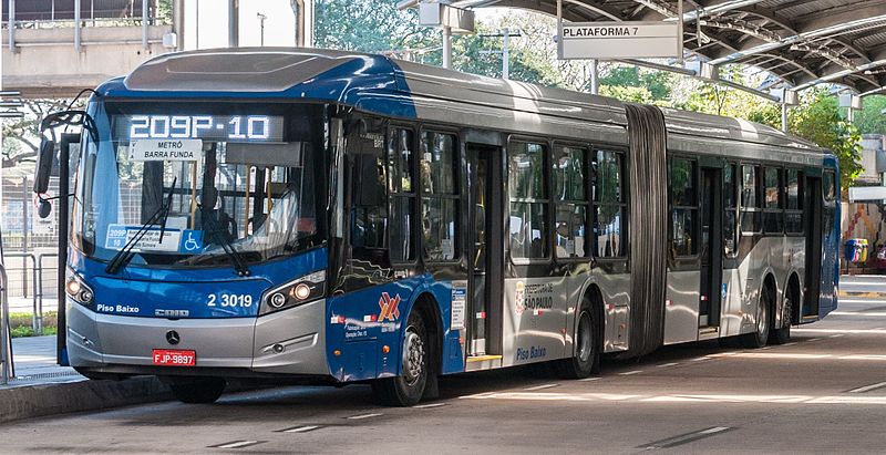
Database contains information such as the length of the bus corridor in kilometers, the company responsible for its operation, identifies the name of the corridors and the year in which the corridor (or part of it) came into operation, and the municipality in which the corridor is located (photo: Wilfredor/Wikipedia)
Agência FAPESP* – The Transfer and Dissemination Team of the Center for Metropolitan Studies (CEM) has prepared a geo-referenced database of 15 different bus corridors in the São Paulo Metropolitan Region (RMSP) in Brazil, totaling almost 200 kilometers of mapped routes.
CEM is a Research, Innovation and Dissemination Center (RIDCs) of FAPESP based at the University of São Paulo (USP) and the Brazilian Center for Analysis and Planning (CEBRAP).
The database contains information such as the length of the bus corridor in kilometers, the company responsible for its operation, identifies the name of the corridors and the year in which the corridor (or part of it) came into operation, and the municipality in which the corridor is located.
Entitled “Bus Corridors – São Paulo Metropolitan Region – 2021,” its cartographic representation results in 49 line segments, due to bifurcations or binaries. The CEM file contains only the corridors that operate on segregated roads, and does not include the exclusive lanes implemented by the transit operator, through which different common bus lines pass. Likewise, the common lines of the São Paulo Metropolitan Urban Transport Company (EMTU), which connect different municipalities in the RMSP, were not included.
According to the CEM study, the implementation of metropolitan bus corridors is a critical issue for the RMSP because there is no governance for this region that can quickly achieve consensus in the implementation of coordinated public policies between the various municipalities that make it up. This prevents, for example, the desired speed in the implementation of works such as bus corridors for intercity lines, which are less complex and less costly than metro lines.
A positive example is the ABD Metropolitan Corridor (São Mateus – Jabaquara), exclusively for buses and trolleybuses, managed by EMTU, with a total length of 33 kilometers. It connects the districts of São Mateus and Jabaquara, in the municipality of São Paulo, and also connects four municipalities belonging to the ABC region of the RMSP: Mauá, Santo André, São Bernardo do Campo and Diadema. When its operator celebrated its 22nd anniversary in 2019, it had an approval rating of 87% among its users.
“The bus corridors database is part of a set of three other cartographic databases produced by the CEM Transfer and Dissemination Team that provide an overview of large-scale public transport in the RMSP,” says José Donizete Cazzolato, a geographer who is part of the team.
In addition to this database, he recalls, the cartographic databases of the metro lines, stations and urban terminals were prepared. These structures, according to Cazzolato, are part of the São Paulo Metropolitan Transport Network, which consists of the metro-rail transport networks, complemented by the EMTU and SPTrans (the São Paulo City Bus Utility) bus corridors.
To download and view the bus corridors database, simply go to the CEM website, go to the “Download Data” channel and select “Cartographic” data and “Transport and Mobility” from the menu on the left. By clicking on “View More” in the title of the database “Bus Corridors – Metropolitan Region of São Paulo – 2021,” the ZIP file containing all the contents will appear for download, which is free of charge, as long as CEM is credited for its use.
*With information from CEM’s Communication and Dissemination Office.
The Agency FAPESP licenses news via Creative Commons (CC-BY-NC-ND) so that they can be republished free of charge and in a simple way by other digital or printed vehicles. Agência FAPESP must be credited as the source of the content being republished and the name of the reporter (if any) must be attributed. Using the HMTL button below allows compliance with these rules, detailed in Digital Republishing Policy FAPESP.
