


Portfolio of startup XMobots includes unmanned aerial vehicles capable of flying for up to ten hours nonstop and monitoring planted areas of less than 1,000 hectares (image: release)
Portfolio of startup XMobots includes unmanned aerial vehicles capable of flying for up to ten hours nonstop and monitoring planted areas of less than 1,000 hectares.
Portfolio of startup XMobots includes unmanned aerial vehicles capable of flying for up to ten hours nonstop and monitoring planted areas of less than 1,000 hectares.
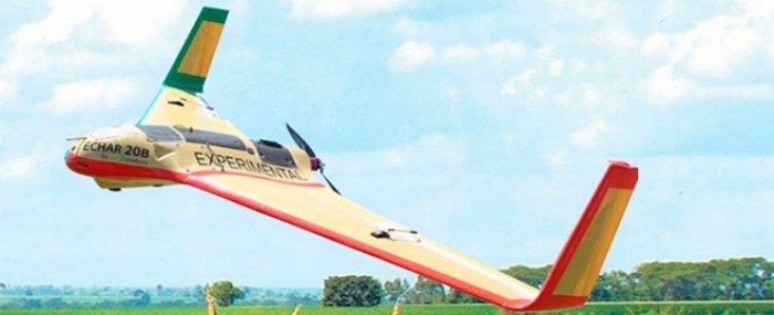
Portfolio of startup XMobots includes unmanned aerial vehicles capable of flying for up to ten hours nonstop and monitoring planted areas of less than 1,000 hectares (image: release)
FAPESP Research for Innovation – The startup XMobots, which specializes in the development and fabrication of remotely piloted aircraft systems (RPAS) for professional applications, is finalizing the certification process for the Supi, its first model to fly over urban areas.
“Our talks with DECEA, the Department of Airspace Control, and ANAC, the National Civil Aviation Agency, are well advanced,” says Giovani Amianti, CEO of Xmobots. The firm is developing the project with the support of FAPESP’s Innovative Research in Small Business Program (PIPE).
“We’re asking for permission to fly in adapted airspace, which our drone is capable of accessing without depending on a NOTAM [Notice to Airmen, which must be issued by Air Force Command at least seven days before an unmanned aircraft operation in Brazil]. Integration with airspace in this case is performed by the flight controller, requiring that the aircraft be fitted with a series of systems and controls that enable the controller to ‘see’ it.”
Founded in 2004 by nine master’s and PhD students at the University of São Paulo’s Engineering School (POLI-USP), XMobots was incubated at the Center for Innovation, Entrepreneurship & Technology (CIETEC), attached to the university’s Energy & Nuclear Research Institute (IPEN-USP). The first project, approved by PIPE in 2009, involved the development of the Apoena.
In 2010, XMobots won a grant from FINEP, the Brazilian Innovation Agency, and CNPq, the National Council for Scientific & Technological Development, to bring the Apoena to market. The following year, it signed its first commercial contract for the mapping and quantification of deforestation around the Jirau Hydroelectric Development, under construction on the Madeira River in Rondônia.
The Apoena operated for 18 months. Meanwhile, the firm was developing the Nauru 500A, which was to replace the Apoena on missions in the Amazon. At the time, the firm produced an aircraft every three months with a team of ten people.
In 2013, XMobots was awarded an Experimental Flight Authorization Certificate (CAVE) from ANAC for the Nauru to fly in segregated areas. The new model, the Nauru 500B, can fly for up to ten hours without recharging, weighs 25 kilograms, and has a wing span of 3.5 meters.
In 2012, 3D mapping (aerotriangulation) software opened up the topography market to RPAS, also known as unmanned aerial vehicles (UAVs). XMobots seized this opportunity by developing the Echar 20A, “the first entirely automatic Brazilian RPAS and the first automatic drone to win certification from ANAC,” Amianti says.
The Echar can fly for 90 minutes without recharging, weighs 7.5 kilograms, and has a wing span of 2.1 meters. In 2014, with the possibility of using RPAS in precision agriculture, the firm launched the Arator, which weighs only 3.2 kilograms and has an innovative aeronautical design. “It’s the first UAV in the world to use inverted landing gear, which protects the onboard cameras,” Amianti says.
As a result, XMobots has a diversified product portfolio. The Nauru is ideal for customers with areas exceeding 10,000 hectares. The Echar is best for areas of between 1,000 and 10,000 hectares. The Arator covers areas of less than 1,000 hectares. “With the use of a multispectral sensor, it’s possible to detect crop damage, quantify the number of plants, identify invader plants and make corrections,” Amianti explains.
In 2016, XMobots launched the Echar C, which can fly for up to 2.5 hours, and a new mission design software tool called XPlanner. “We’re also finalizing the testing of an autonomous flight helicopter for localized crop spraying,” Amianti says.
Company: XMobots
Site: www.xmobots.com
Address: Rua Gelsomino Saia, 88
Jardim Maracanã, São Carlos (SP), Brazil 13571-310
Tel.: +55 16 3413-0655
Email: contato@xmobots.com.br
The Agency FAPESP licenses news via Creative Commons (CC-BY-NC-ND) so that they can be republished free of charge and in a simple way by other digital or printed vehicles. Agência FAPESP must be credited as the source of the content being republished and the name of the reporter (if any) must be attributed. Using the HMTL button below allows compliance with these rules, detailed in Digital Republishing Policy FAPESP.
