


Researchers have developed a new atmospheric global circulation model adapted to climate conditions in South America (image: CPTEC-INPE)
Researchers have developed a new atmospheric global circulation model adapted to climate conditions in South America.
Researchers have developed a new atmospheric global circulation model adapted to climate conditions in South America.
Researchers have developed a new atmospheric global circulation model adapted to climate conditions in South America (image: CPTEC-INPE)
By Elton Alisson | Agência FAPESP – Predictions of extreme weather events in Brazil, including torrential rain, drought, and phenomena caused by El Niño – an abnormal warming of surface and subsurface water in the equatorial Pacific Ocean – may become more accurate in the months ahead.
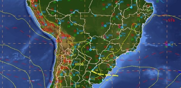
This year, the Center for Weather Forecasting & Climate Studies (CPTEC) at Brazil’s National Space Research Institute (INPE) began producing global weather forecasts for between one and seven days ahead using a new atmospheric global circulation model.
The Brazilian Global Atmospheric Model, or BAM for short, was developed entirely in-house over the past four years by researchers in CPTEC-INPE’s Modeling & Development Division (DMD).
BAM will be the atmospheric component of the Brazilian Earth System Model (BESM), developed to simulate and predict the effects of climate change with support from FAPESP (read more at http://agencia.fapesp.br/16975/).
BAM will be coupled to BESM this year for use in not only climate change projections but also seasonal weather forecasts (up to three months ahead).
“We’ve acquired a great deal of experience in the development of global atmospheric models, in terms of dynamics and physical processes,” said Silvio Nilo Figueroa, head of DMD at CPTEC-INPE and a member of the project. “The atmospheric model used by CPTEC before BAM had been operating since 2010 and was no longer suitable for spatial resolutions of 20 km or less. So, we decided to develop a new model designed to address these resolutions and the climate of South America,” Figueroa told Agência FAPESP.
According to Figueroa, one of the limitations of the global models used in the United States, Europe and other world centers of meteorology is that these models do not adequately represent the topographic and thermal forcings that strongly influence the climate and weather in South America. Climate forcings are natural and man-made factors that affect Earth's climate by driving (forcing) the climate system to change, typically in terms of the planetary energy balance and global temperature. On this continent, the topographic forcing is associated with the Andes, and the thermal forcing is associated with the release of latent heat from Amazon cloud cover.
“Most global numerical atmospheric models fail to represent the Andes chain of mountains because it’s very narrow and its height can vary abruptly over a matter of a few miles,” Figueroa said.
This mathematical problem has a major impact on representing the transport of humidity from the Amazon to the South and Southeast of Brazil, and hence on seasonal weather forecasting, especially for these two regions.
“By improving our global atmospheric climate model to better represent the mountainous regions of South America and cloud formation in the Amazon, we’ll be able to produce better seasonal weather and climate forecasting in Brazil,” Figueroa said. “This will be the key advantage of our model over other global models, and a Brazilian contribution to the international scientific community.”
BAM will also improve the representation of rain in the Amazon, he added. Research projects such as CHUVA and Green Ocean Amazon (GOAmazon), both supported by FAPESP, will help the team adjust BAM to enhance its representation of cloud formation in the Amazon.
“Enhanced representation of both Amazonia and the Andes in the model means we can expect more reliable and better quality weather and climate forecasting for the Southeast region,” Figueroa said.
Better resolution
Another advance in BAM, according to Figueroa, will be the increased spatial resolution of the weather and climate forecasts produced by CPTEC.
The atmospheric global circulation model used hitherto by the institute (AGCM3) processed forecasts with a spatial resolution of 45 km and 64 vertical layers.
BAM processes forecasts with a spatial resolution of 20 km and 96 levels in the vertical.
Better resolution means better representation of South America’s topography, dynamics (atmospheric movement equations), and physics (e.g., radiation, soil layers, land surface processes, and microphysics).
Moreover, the forecasts will be produced more than two days ahead, an outcome that was not possible using the previous model.
“The old model’s performance began to deteriorate after the second day. With BAM, we can produce more reliable weather forecasts further in advance,” Figueroa said.
BAM ran experimentally for a year and has been tested in pre-operational mode for the last three months. During this period, the researchers evaluated the model’s performance in forecasting rainfall over the Southeast region. The results of the assessment showed that forecasts using the model were of similar quality to those produced by the Global Forecast System (GFS) at the US National Centers for Environmental Prediction (NCEP), considered one of the best models in operation in the world.
“BAM was able to forecast a few days in advance the heavy rain storms that hit the region last month because of the South Atlantic Convergence Zone,” Figueroa said. This zone is a cloud band that extends from southern Amazonia southeastward into the central South Atlantic.
The forecasts produced by BAM encompass large areas of the planet with a spatial resolution of 20 km, Figueroa explained, so they cannot capture signs of weather changes in a smaller area such as a municipality in metropolitan São Paulo. Forecasts for smaller areas require regional models with spatial resolutions of between 1 km and 10 km, such as ETA and BRAMS, both of which are used by CPTEC-INPE.
Global models such as BAM, however, feed regional models with boundary conditions, i.e., atmospheric conditions on the borders of the regions covered by regional models. The quality of the forecasts produced by regional models therefore also depends partly on the quality of global models’ forecasts of atmospheric conditions.
“Global atmospheric models provide data on temperature, wind and other variables at the edges of regional models at intervals of three to six hours so that regional models can produce one-day forecasts for their respective domains,” Figueroa said.
For example, BAM will supply boundary conditions to the 1 km regional models that will be used to gauge forcings in wind, wave, and current forecasts for Guanabara Bay during the Rio de Janeiro Olympics, he noted.
Computing capacity
According to Figueroa, BAM is ready to run at an even better spatial resolution of 10 km, but computing capacity limitations are a constraint. CPTEC-INPE’s Tupã supercomputer is operating close to the limit of its capacity, he said. Tupã was acquired at the end of 2010 by the Ministry of Science, Technology & Innovation (MCTI) and FAPESP (read more in Portuguese at http://agencia.fapesp.br/13249/).
A test performed by the researchers at CPTEC-INPE to evaluate Tupã’s performance in processing BAM, which was adapted to a spatial resolution of 10 km, showed that even with the supercomputer at full capacity, using its 30,000 processors for two hours, only 24-hour forecasts could be produced.
A computer 28 times more powerful, for example, would take approximately one hour to produce forecasts up to seven days in advance, the researchers said. Tupã cannot do this, and its capacity to produce seasonal climate forecasts with high spatial resolution is also limited, according to Figueroa.
“The most we’ve succeeded in doing with Tupã so far is running BAM with a spatial resolution of 20 km,” he said. “If we had more computing capacity, we could run the model with a resolution of 10 km.”
BESM, in which BAM will be one of the main components, is now running with a spatial resolution of approximately 180 km. Ideally, the model of the terrestrial system for climate change studies and seasonal forecasting should run with a spatial resolution of 100 km or less, according to Figueroa.
“The better the model’s spatial resolution, the better it can represent topography, such as valleys and mountains, and the contrast between the sea and the mainland,” he said. “With a spatial resolution of 180 km, these contrasts are not clear-cut, and the shore may look like dry land.”
Institutions such as NCEP in the US, for example, have the capacity to run global atmospheric weather models at a spatial resolution of 13 km using supercomputers capable of 1 petaflops (1015 floating-point operations per second), or between 30 and 50 times faster than Tupã.
“Five to seven years from now, global models will be running with a spatial resolution of 1 km-2 km, and it won’t be necessary to use regional models,” Figueroa said. “The topography of a region like the Paraíba Valley will be much better represented by the global models.”
The idea is that BAM should be the starting point for the development of CPTEC-INPE’s next-generation global atmospheric model. When that time comes, the same model will be used for global weather forecasting at a resolution of less than 5 km and for seasonal climate and climate change forecasting with a resolution of 10 km-25 km.
The Agency FAPESP licenses news via Creative Commons (CC-BY-NC-ND) so that they can be republished free of charge and in a simple way by other digital or printed vehicles. Agência FAPESP must be credited as the source of the content being republished and the name of the reporter (if any) must be attributed. Using the HMTL button below allows compliance with these rules, detailed in Digital Republishing Policy FAPESP.
