

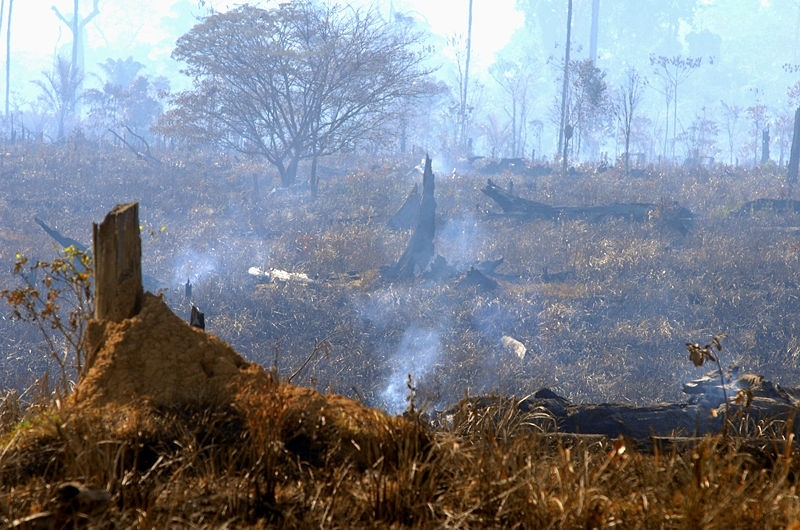
Scientists have developed a regional algorithm to produce monthly maps of forest fires based on remote sensing data from NASA's satellites (photo: wildfire in São Felix/Valter Campanato/ABr)
Scientists have developed a regional algorithm to produce monthly maps of forest fires based on remote sensing data from NASA's satellites.
Scientists have developed a regional algorithm to produce monthly maps of forest fires based on remote sensing data from NASA's satellites.
Scientists have developed a regional algorithm to produce monthly maps of forest fires based on remote sensing data from NASA's satellites (photo: wildfire in São Felix/Valter Campanato/ABr)
By Elton Alisson | Agência FAPESP – The areas affected by forest fires in Brazil can now be measured more accurately, thanks to an automated algorithm developed by researchers at the National Space Research Institute (INPE).
The algorithm produces a monthly map of vegetation burnings based on remote sensing data from NASA’s Moderate Resolution Imaging Spectroradiometer (MODIS).
Developed as part of a postdoctoral research project supported by a scholarship from FAPESP, the algorithm is up and running at INPE, where it is used by the institute’s Wildfire Monitoring Group to generate monthly nationwide estimates of ongoing burned areas and also retroactively since 2005.
“The new algorithm has improved the estimates and produces maps of far higher quality than we had before,” said Renata Libonati, who developed the algorithm during a postdoc fellowship at INPE. Her supervisor was Alberto Setzer, who heads INPE’s Wildfire Monitoring Group.
Libonati, currently a professor at the Meteorology Department of the Federal University of Rio de Janeiro (UFRJ), told Agência FAPESP that burned areas in Brazil had hitherto been mapped using algorithms developed by NASA for global remote sensing purposes.
Despite the advantage of enabling worldwide observation of wildfires, there are problems with remote sensing on a global scale and constraints on its regional use, Libonati explained.
“Global remote sensing is generalized, covering various biomes,” she said. “It doesn’t take account of regional characteristics such as type of vegetation, soil and climate. Several studies have shown striking divergences in the quantification of burned areas produced by these global-scale remote sensing systems, in terms of both annual area and the location of the burned areas.”
To surmount these limitations of global-scale remote sensing systems, Libonati developed a regional algorithm, called AQM, which has a spatial resolution of one square kilometer (1 km2).
AQM is based on a burn-sensitive vegetation index obtained from daily values of middle-infrared (MIR) radiance, near-infrared (NIR) reflectance and thermal-infrared (TIR) brightness temperature acquired by the MODIS instruments on board the Terra and Aqua satellites, as well as data from a number of other fire detection sensors monitored by INPE.
To validate the algorithm, the researchers performed a study, published in the journal Remote Sensing, in which they evaluated its capacity to detect and quantify burned areas in Jalapão, Tocantins, part of the Cerrado biome. They compared the results obtained with reference data derived from the Landsat orbital system for the region and with those of the algorithms used by NASA to quantify burned areas on a global scale.
The Cerrado biome, which has been increasingly affected by anthropogenic fires in recent years, is a mosaic of savannas with varying tree density.
The validation exercise showed that the regional algorithm estimated burned areas in the region much more accurately than the algorithms used by NASA.
“There are omission errors in the algorithms NASA uses, which fail to pinpoint the location and size of many burned areas,” Libonati said. “Using the algorithm we developed, we were able to diminish these errors and enhance the detection of burned areas.”
The researchers also used the algorithm to develop a database of monthly burned area maps covering the entire country for the period 2005-2014.
They now aim to continue enhancing estimates of burned areas throughout Brazil using more refined orbital sensors such as the Visible Infrared Imaging Radiometer Suite (VIIRS) on NASA’s Suomi National Polar-orbiting Partnership (Suomi NPP) satellite, which has been acquiring images of Earth since October 2011.
“Although the results of the algorithm developed for MODIS are satisfactory, the method still needs to be enhanced by means of new validations in other biomes,” Libonati said. “In addition, this algorithm is being adapted for use with the new VIIRS, which offers more refined information at a resolution of 375 meters.”
Wildfire census
The researchers plan to improve the algorithm in order to obtain data on the burned areas in all of Brazil’s biomes. According to Libonati, the data will be useful not only for environmental monitoring purposes and to reduce uncertainty when calculating emissions and dispersal from forest fires, but also for the analysis of forest fire impact as a part of future climate change scenarios.
“Burnings are associated with ecosystem degradation, respiratory disease in local communities, and emissions of greenhouse gases, aerosols and trace gases,” she said. “Any attempt to characterize and mitigate the impact of forest fires on the climate presupposes a store of reliable data on the location and size of the areas affected by wildfires.”
According to experts, the conversion of natural vegetation into pasture and cropland by burning is the main source of greenhouse gas emissions and particulate matter (aerosols) in Brazil, as well as emissions of trace gases such as CO2 and methane.
At the same time, forest fire frequency, size and severity is likely to increase owing to climate change associated with shifts in land use, global warming, and drier warmer weather.
The researchers note in the paper that these concerns indicate the need for reliable fire information for use by policymakers, scientists and resource managers.
“For example, we expect the results of the algorithm to be used to quantify Brazil’s progress in meeting its REDD targets, a treaty obligation of the Brazilian government,” Libonati said.
A scheme introduced by the UN Framework Convention on Climate Change (UNFCCC), REDD (Reducing Emissions from Deforestation & Forest Degradation) designates a set of economic incentives for reducing such emissions.
The article “An algorithm for burned area detection in the Brazilian Cerrado using 4 µm MODIS imagery” (doi: 10.3390/rs71115782) by Libonati et al. can be read in Remote Sensing at mdpi.com/2072-4292/7/11/15782/htm.
The Agency FAPESP licenses news via Creative Commons (CC-BY-NC-ND) so that they can be republished free of charge and in a simple way by other digital or printed vehicles. Agência FAPESP must be credited as the source of the content being republished and the name of the reporter (if any) must be attributed. Using the HMTL button below allows compliance with these rules, detailed in Digital Republishing Policy FAPESP.
